Colorado Wildfires: How We Got Here

As the next wildfire season approaches, Coloradans are still recovering from the 2020 season that brought the most acres burned and the largest infernos in state history. Colorado wildfires are growing in size every decade, forcing citizens and public land stewards to search for new ways to cope with and curtail future super-fires.
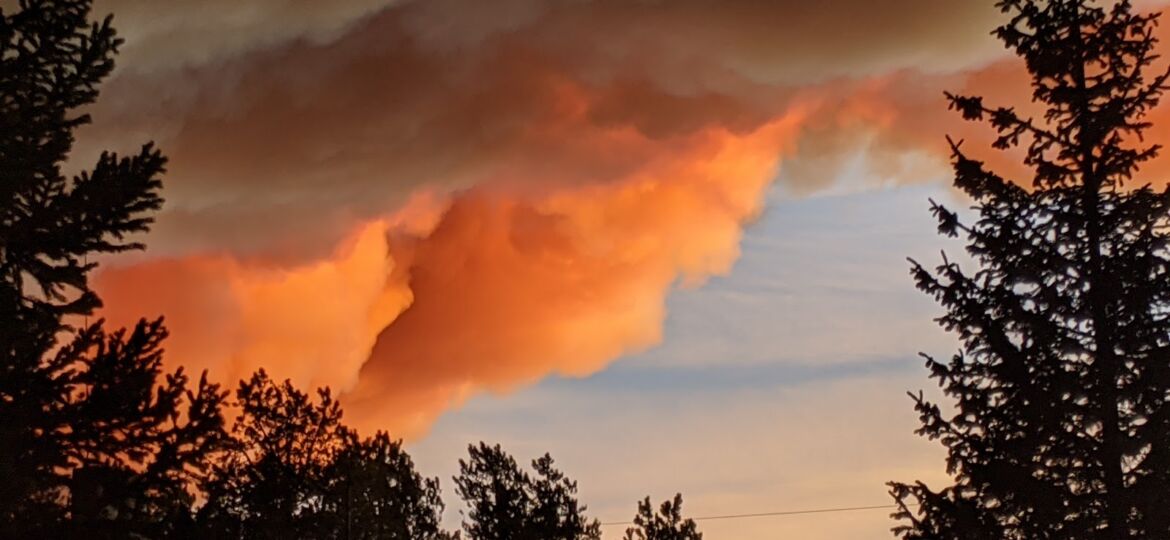
Residents like Scott Huff, who barely escaped the East Troublesome Fire last October, are experiencing the impact of more prolonged and deadlier wildfire seasons.
“I stepped out into the road, and I looked West; all I could see was red,” Huff said. “It’s like, this is real; this is headed this way.”

The evacuation order came 15 minutes after the pre-evacuation notice, Huff said. He and his wife Jeannie Wilkinson loaded their trailer with essential memorabilia, then set off to the East Grand School District bus barn for night’s shelter. After a few anxious days, they learned they were one of the lucky ones, home spared of the fire’s wrath.
Why It’s Important
The infernos were like none ever recorded in state history. To understand how much 2020 stood out, we analyzed over 15,000 wildfires located in or around Colorado National Forests since 1970. Trends show more frequent and disastrous blazes over the decades. Graphing the total acres burned every year reveals that before the year 2000, Colorado rarely experienced wildfires over 5,000 acres.
Even for veterans like Mike Lewelling, fire management officer for the Rocky Mountain National Park, last year was unlike anything he witnessed during his 30 years working to combat and extinguish wildfires.
“The morning of the 22 or 23 of October when we found the fire had jumped the Divide,” Lewelling recalled of the East Troublesome Fire. “I went out at 1 o’clock in the morning to upper Beaver Meadows looking to the North, and I don’t know if I’ve ever had a feeling of foreboding that something really bad is going to happen today.”
All five of the 100,000 acres-plus wildfires in state history struck within the past 20 years. Three of those fires, Cameron Peak, East Troublesome and Pine Gulch, tortured the state in 2020. Earth Lab Director at the University of Colorado Boulder, Dr. Jennifer Balch, said wildfires are both exacerbated by and contribute to climate change.

“Our 2020 wildfire season is showing us that climate change is here and now in Colorado,” Balch said. “Warming is setting the stage for a lot of burning across an extended fire season.”
Balch explains that the average temperature in western and northern Colorado increases at twice the global average due to climate change. This increase caused a tripling of the state acreage burned in the past decade over the prior 30 years. These regions experience droughts at an increasing rate, reducing snowpack and causing warmer and dryer conditions earlier in the spring.
Unique Challenges
In addition to global climate change, Colorado finds itself in a perfect storm of conditions for significant wildfire events. An explosion of bark beetles devastated the lodgepole pine population, turning these large trees into tinderboxes. Combined with decades of fire suppression, large swaths of the state are ripe for ignition. As the wildland-urban interface (the area where human development meets undeveloped land) spreads throughout the state, traditional fire mitigation techniques are increasingly unavailable.
“In lodgepole, there’s no surrogate to fire,” Lewelling said about fire mitigation near Estes Park. “You can’t really prescribe burn it because it just won’t burn,” Lewelling continued. “If it does burn, you’ve got a hundred-foot flame next to houses, so you can’t really control it.”
These communities are under serious threat from wildfires due to their extreme proximity to nature.
A bark beetle explosion began over two decades ago in Colorado, Lewelling said. Beetles destroy older pine, which shed their dead needles, allowing sunlight through the canopy. Grass, brush, weaker pine and other kindling material take their place.
“As the trees die, the roots rot really fast and make them incredibly unstable,” Lewelling said. “So these trees fall for no reason. I mean, you could have no wind at all, and they fall.”
The changing Colorado landscape means firefighters are changing their approach to dealing with fires in the state. Front line attacks are often off the table with current wildfires due to the changing terrain, Lewelling said. Communicating this to external teams is one of his primary duties during a fire event.
“They may try to send people in there where we know that we’re going to kill somebody,” Lewelling emphasized.
Mitigation
The danger to the wildland-urban interface is increasing, Lewelling said. However, that doesn’t mean his team was unprepared for last summer; tackling the East Troublesome Fire was an event his team planned for 20 years.
“Our fuels projects played a significant role in stopping the fire from coming into town,” Lewelling said. “We had backups.”
Fuels reductions projects preemptively fight fires by thinning smaller and dead trees near the wildland-urban interface to limit wildfires’ potential routes, Lewelling explains. Although very successful, these projects often only leave the tall lodgepole pines that were eventually ravaged by bark beetles- turning wilderness to open plains.
Additional fire mitigation projects include capacity-building grants for community groups alongside other government agencies and district programs, according to the Colorado State Forest Service. These grants fund projects to help maintain hazardous fuels, reduce waste disposal, implement safety measures and other risk reduction techniques.
Individual residents can seek direct forest-management assistance through the forest service to tap into wildfire risk mitigation grants, stewardship programs and homesite assessments.
Bottom Line
Ignoring the link between climate warming and wildfires only puts lives and homes at risk, Balch said. We need more proactive solutions to manage our increasingly flammable landscapes.
“With climate change making our fuels that much drier, we need to be that much more careful,” Balch continued. “There are lots of ways human activities & infrastructure start fires: campfires, debris burning, fireworks, powerlines, et cetera.”
Although 2020 was the worst wildfire season in Colorado’s history, Lewelling remains cautiously optimistic and focuses on fire mitigation near the wildland-urban interface.
“The threat to Estes Park and the communities on the east side is real,” Lewelling said. “We’re doing what we can to try to mitigate that risk.”
As for Huff and Wilkinson, they are just glad to be back home, thankful to a community coming together in support.
“It’s what people do,” Huff said. “We pull together; we take care of each other. The human spirit- It doesn’t seem to matter where it is.”
Nerd Box
Visualizations for this article were created from a compiled list of 18,000+ wildfire records 1970-2019 from the National Fire and Aviation Public access fire reports for causes by year and district for all 11 Colorado National Forests and the Pawnee National Grassland. The U.S. Forest Service manages the database.
Data for 2020 from the public fire reports are incomplete; this year’s data is provided by InciWeb and limited to the Middle Fork, Cameron Peak, East Troublesome, Cal-wood, Williams Fork and Grizzly Creek fire – Last updated 3/31/21.
The U.S. Forest Service said rules for entering fire records changed many times since 1970. Although this dataset is extensive, it is not a perfect history. For example, It was not always mandatory to report the latitude/longitude for each fire; over 3,000 records are missing coordinates in this report. The average incident date for the missing information is 1976. We decided to include these records in the analysis to avoid making the past couple of decades appear any worse than reality. The 3,000 records are in the bar chart but not on the map.
The U.S. Forest Service’s data contains any fire that burned at least one-tenth acre on land managed by the forest service.
The map shows ignition points and does not depict burned areas. The sizes of the circles solely represent the size in correlation with the other fires on the map.
We added the incident label ‘lightning’ for the 2019 Decker Fire that was unlabeled in public fire reports and changed the 2002 Hayman Fire category from ‘other’ to ‘arson’- Terry Barton was convicted for this fire.
Excel and Flourish are the two tools used to analyze and create data visualizations for this article.